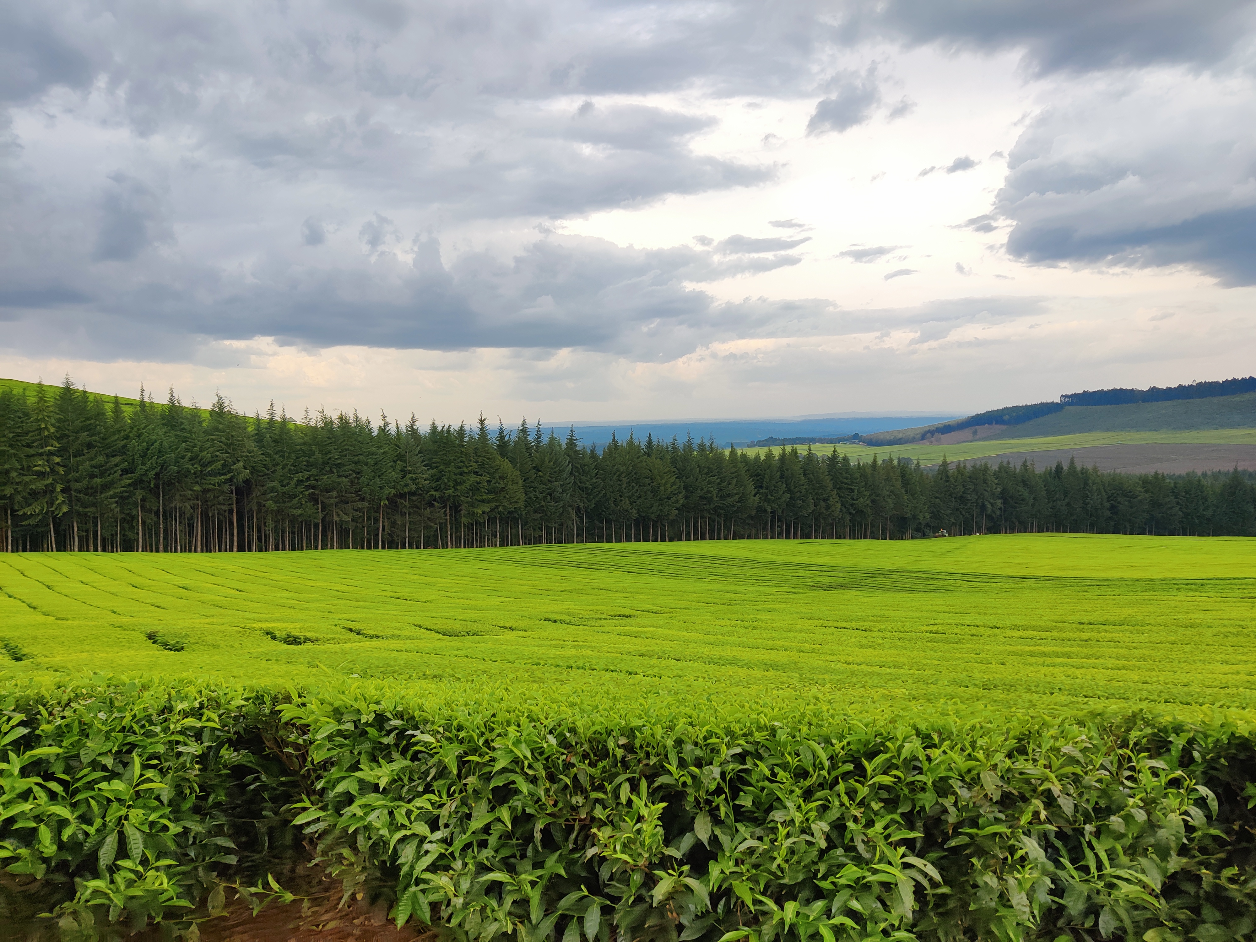
Precision Agriculture: Elevating Efficiency with Drones
At Fahari Aviation, we excel in creating a highly efficient business ecosystem by enhancing processes and establishing a strong agricultural framework. We utilize advanced technology and innovative solutions to meet current and future customer demands, significantly contributing to community socio-economic growth.
Precision Spraying & Spreading
Drone-based spraying or spreading help you reduce chemical usage, enhance protection, increase efficiency, and increase cost.
Crop Health Assessments and Monitoring
We analyze multi-spectral imageries to identify nutrient imbalances, disease outbreaks, and water stress early.
Yield Prediction & Optimization
We integrate drone data, environmental factors, and agronomic knowledge for accurate forecasting, risk reduction, and profitability.
Multispectral Imaging for Agriculture
Multispectral imaging uses specialized sensors to capture data across various light spectrums, providing invaluable insights into crop health, water content, and overall field conditions. This technology enables precision agriculture, leading to optimized resource use, increased yields, and sustainable farming practices.
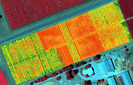
NDVI (Normalized Difference Vegetation Index)
Quantifies vegetation health and density using red and near-infrared bands.
Benefits:
- Early detection of crop stress
- Monitoring growth patterns
- Yield prediction
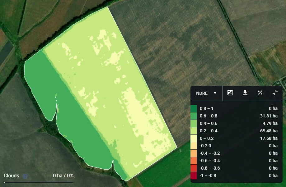
NDRE (Normalized Difference Red Edge Index)
Measures chlorophyll content in plants using red edge and near-infrared bands.
Benefits:
- Ideal for mid-to-late season assessments
- Nutrient management
- Crop maturity analysis
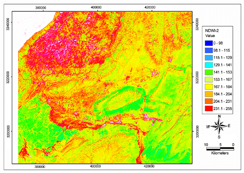
NDWI (Normalized Difference Water Index)
Evaluates water content in vegetation using near-infrared and short-wave infrared bands.
Benefits:
- Monitoring plant water stress
- Irrigation management
- Drought assessment
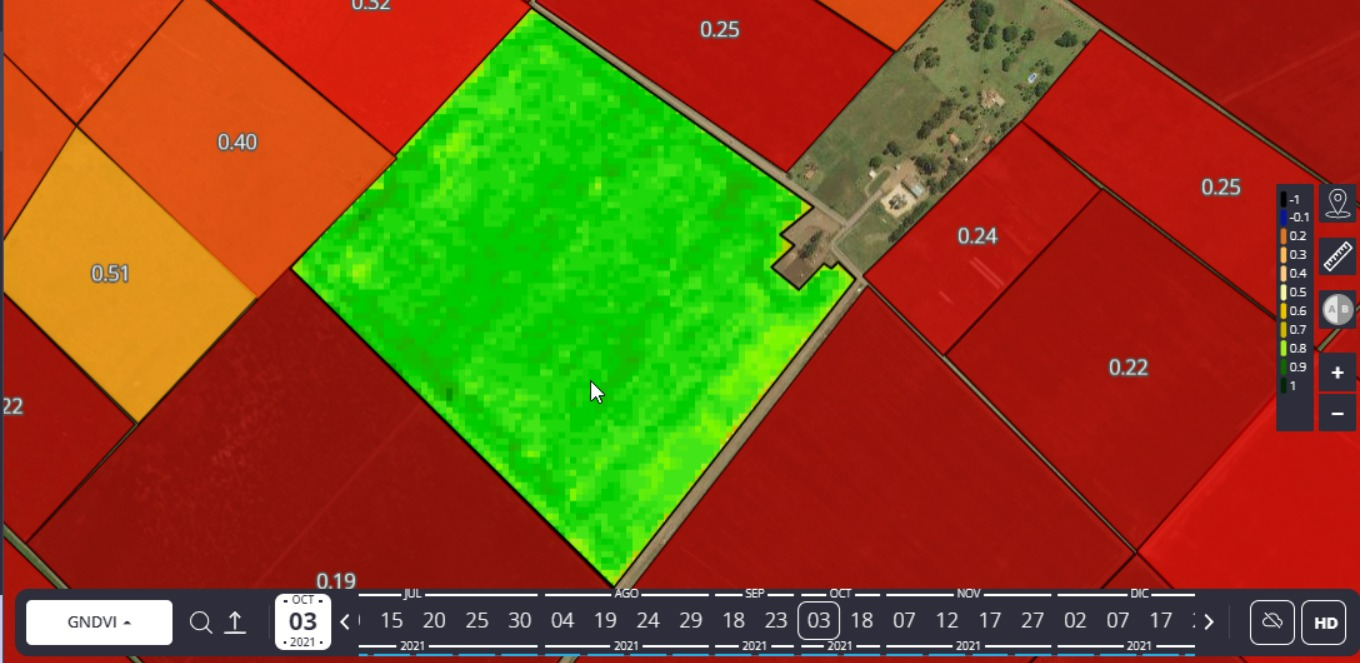
GNDVI (Green Normalized Difference Vegetation Index)
Estimates photosynthetic activity using green and near-infrared bands.
Benefits:
- Assessing nitrogen uptake
- Chlorophyll content
- Overall plant vigor
How Drones Revolutionize Agriculture
Our advanced drone technology employs state-of-the-art sensors, high-resolution cameras, and AI-powered analytics to provide farmers with unprecedented insights into their crops and land. This cutting-edge solution enhances agricultural efficiency, sustainability, and yield optimization.
High-Resolution Imaging
High-resolution multispectral imaging allows for detailed crop health analysis, identifying issues such as pest infestations, nutrient deficiencies, and water stress before they become visible to the naked eye.
Precision Mapping
Precision mapping and 3D modeling capabilities enable accurate field surveying, crop counting, and yield estimation, helping farmers make data-driven decisions about resource allocation and harvest planning.
Precise Application
Equipped with precision spraying systems, our drones can apply fertilizers, pesticides, and other treatments with pinpoint accuracy, reducing chemical usage and minimizing environmental impact while maximizing effectiveness.
Interested in precision agriculture using drone technology?
Get in touch with our specialists for innovative drone solutions.
GET IN TOUCH